REAL ESTATE, FARM LAND FOR SALE LISTINGS
We have real estate listings for farm land and ranch land for sale. Periodically we have landowners with commercial property located in or close to Fremont willing to sell but do not wish to openly market their property. Call for availability and specific details.
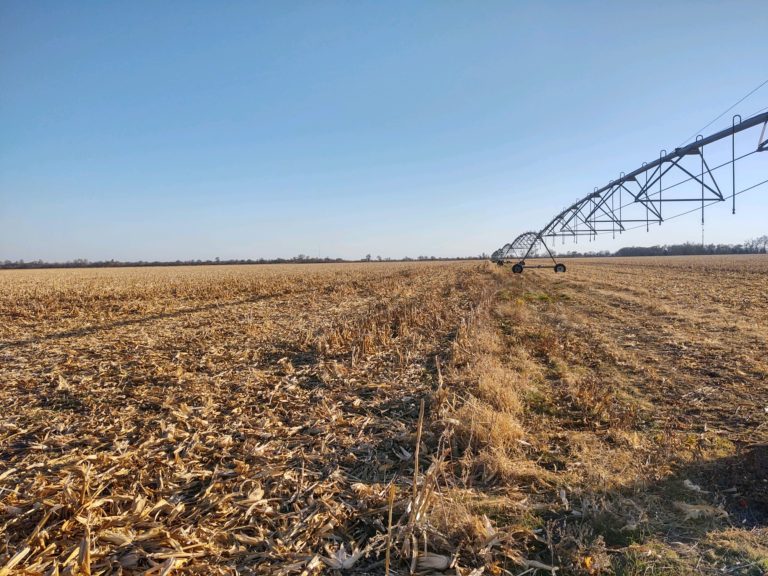
Lancaster County, NE
62.0 Acres +/-
Asking Price: $465,000
Location: Located three quarter mile east of NW140th Street on the north side of West Branched Oak Road to the west of Branched Oak Lake, Raymond, NE.
Legal: Part of Phase 2 “outlot”, aka western part of Lot 17 SE located in the SE1/4 of Section 30, Township 12 North, Range 5 East of the 6th P.M., Lancaster County, NE. (Lengthy survey legal description).
Description: The property is consists of rolling non- irrigated cropland with older terraces and grass waterways. The property is Zoned: “Ag Preservation” with building restrictions to agricultural structures only. Property is income producing with potential for hunting recreational enhancement.
Real Estate Taxes: The property taxes for 2025 included additional land (73.85 acres) and totaled $3,740.52. Seller will pay the 2025 real estate taxes and prior years. The 2026 real estate taxes will be negotiated in purchase contract relative to the farm income and closing.
Possession: Possession of the property will be granted upon final closing subject to tenant’s lease rights of possession. Owners lease rights are subject to purchase agreement negotiation. The 2026 carryover 60/40 crop share lease will be assumed by the buyer unless renegotiated via purchase agreement.
Dodge County, NE
241.0 Acres +/-
Sale Pending!
Location: The farm is located northwest of North Bend, Nebraska. The southwest corner of the property is the intersection of County Road 3 & County Road M.
Legal: The Southwest Quarter (SW1/4), North half of the Southeast Quarter (NW1/2SE1/4) and Part of Tax Lots 10 all in Section 33, Township 19 North, Range 5 East of the 6th P.M., Dodge County, NE.
Description: The property is consists of high quality non- irrigated cropland. The west part of the farm is rolling upland and the east features nearly level and gently rolling topography. Farm Service Agency records show 228.5 acres of tillable cropland.
Survey: Seller will provide survey of property. Seller is willing to split the property between FSA map field #1 and FSA map fields #2 & #3. There will be no adjustment to sale price if surveyed acreage results in more or less acreage than reported as taxable. Tract Split Map
Real Estate Taxes: $12,103.26 (2025)
Possession: Possession will be granted upon completion of final closing. The cropland and grain bins are subject to farm tenants lease rights expiring February 28, 2026. Full possession for the 2026 crop year.
Dodge County, NE
16.0 Acres +/-
SOLD $147,500
Location: From the HWY 79 and HWY 30 intersection north of North Bend, Nebraska the property is 4 miles north to Foothill Road and 1.5 miles east. Property is located northeast of the Foothill Road and County Road 9 intersection.
Legal: Tax Lot 1 in Section 16, Township 18 North, Range 6 East of the 6th P.M., Dodge County, NE.
Description: The property contains 16.0 taxable acres and is currently utilized for cropland. The land is situated on the north bluff of the Platte River valley and offers panoramic views.
Real Estate Taxes: $520.10 (2024)
Possession: Possession will be granted upon completion of final closing, subject to farm tenant lease rights expiring December 31, 2025.
Hall County, NE
143.96 Acres +/-
SOLD! $630,000
Location: From the HWY 11 and Kansas St intersection in Cairo, Nebraska the farm is 1.5 miles east on the north side of the road. Property is located on the North side of W One-R Road and the West side of N Burwick Road.
Legal: Part of the Southeast Quarter (SE1/4) in Section 17, Township 12 North, Range 11 West of the 6th P.M. Hall County, NE.
Description: The property contains 61.6 certified irrigated acres of gravity irrigated cropland and 43.63 acres of non-irrigated cropland. The topography is nearly level and the farm consists of mostly Class I soil types. The balance of the farm is in grass that is put for prairie hay and timber with a creek running through it.
Real Estate Taxes: $6,381.34 (2023)
Possession: Possession of the farm will be granted upon completion of final closing, subject to farm tenant lease rights expiring February 28, 2025. Farm is subject to a cash rent lease for the 2024 crop year. Full possession for the 2025 crop year.
Saunders County, NE
79.4 Acres +/-
SOLD! $12,000/ Acre
Location: From the HWY 109 intersection at Cedar Bluffs, Nebraska the farm is 2.25 miles south on the east side of the highway.
Legal: The South One-Half of the Northwest Quarter (S1/2NW1/4) in Section 14, T16N, R7E of the 6th P.M., Saunders County, Nebraska.
Description: The property contains 78.48 acres of center pivot irrigated cropland. The topography is nearly level and the farm consists of mostly Class I & II soil types. The irrigation well has a capacity of 800 gpm (Well #199509). The irrigation well, gearhead, propane motor, and an older center pivot sell with the property. There are also two older grain bins that sell with the property. The propane tank is property of the farm operator and does NOT sell with the property.
Real Estate Taxes: $6,290.92 (2023)
Possession: Possession of the farm will be granted upon completion of final closing, subject to farm tenant lease rights expiring February 28, 2025. Farm is subject to a cash rent lease for the 2024 crop year. Full possession for the 2025 crop year.
Dodge County, NE
160 Acres +/-
SOLD! $1,750,000
Location: From the HWY 79 & HWY 30 intersection north of North Bend, Nebraska the farm is 1.50 miles east and 1.0 mile north or southwest of the intersection of County Road R and County Road 9.
Legal: The Northeast Quarter (NE1/4) in Section 32, T18N, R6E of the 6th P.M., Dodge County, Nebraska.
Description: This is an excellent quality center pivot irrigated cropland farm. The farm topography is nearly level and the farm features nearly all Class II soil types. The are 157.4 acres of tillable cropland. The irrigation well provides good water to the center pivot and is registered (Well #089290). The pump for the irrigation well was rebuilt prior to the 2023 growing season. The irrigation well and gearhead sell with the property. The diesel power unit, fuel tank and center pivot are property of the farm operator and do NOT sell with the property.
Real Estate Taxes: $8,887.76 (2023)
Possession: Possession of the farm will be granted upon completion of final closing, subject to farm tenant lease rights expiring February 28, 2025. Farm is subject to crop share lease for the 2024 crop year. Full possession for 2025 crop year.
Saunders County, NE
80.0 Acres +/-
SOLD! $12,000/ Acre
Location: The farm is located 5.0 miles west and 1.75 miles south of Cedar Bluffs, Nebraska on the intersection of County Road 22 and V.
Legal: The S1/2SE1/4 in Section 10, T16N, R6E of the 6th P.M., Saunders County, Nebraska.
Description: The subject property contains 73.82 acres of center pivot irrigated cropland. The property includes one irrigation well with a newer 50 horsepower electric motor and two older center pivots. The farm has productive Nodaway silt loam, Yutan Judson complex and Judson silt loam soil types.
Real Estate Taxes: $3,997.10 (2022)
Possession: Possession of the farm will be granted upon completion of final closing, subject to owner harvesting 2023 soybean crop. Full possession for 2024 crop year.
Dodge County, NE
80.47 Acres +/-
Sold! $14,500/ Acre
Location: From the Highway 30 & 275 interchange north of Fremont the farm is 1.5 miles north to Rosedale Road and .5 miles east to the southwest corner of the property.
Legal: The E1/2NE1/4 in Section 26, T18N, R8E of the 6th P.M., Dodge County, Nebraska.
Description: The property is a nearly level non- irrigated farm with productive soil types. There are 76.82 acres of tillable cropland. The farm is located in close proximity to Fremont and Highway 275/ Highway 77.
Real Estate Taxes: $5,121.16 (2022)
Possession: Full Possession of the farm will be granted upon completion of final closing, subject to tenant lease expiration February 28, 2024. Full possession for 2024 crop year.
York County, NE
40.35 Acres +/-
Sold! $13,500/ Acre
Location: The farm is on the West edge of York, Nebraska. Go 1/4 mile East of the Highway 81 and Highway 34 West interchange. The farm is on the Southeast side of the W 25th St and L Road intersection.
Legal: The W1/2NW1/4 in Section 36, T11N, R3W of the 6th P.M., York County, Nebraska excluding the highway ROW & irregular tract No. 19.
Description: The subject property contains approximately 39.14 acres of gravity irrigated cropland. The cropland is nearly level with productive Hastings Silt Loam soil types. Property is zoned agricultural but has great potential for commercial development with the property being right off the highway.
Real Estate Taxes: $3,964.54 (2022)
Possession: Full Possession of the farm will be granted upon completion of final closing, subject to tenant lease expiration February 28, 2024. Full possession for 2024 crop year.
Butler County, NE
28.1 Acres +/-
Sold! $121,000
Location: From Linwood, 1.5 miles South on X road and 1 mile East on 45 road to the intersection of Y road and 45 road, to the Northeast corner of the farm.
Legal: Part of the N1/2NE1/4 of Section 1, T16N, R4E of the 6th P.M., Butler County, Nebraska. (Tower is not included)
Description: There are approximately 27.36 acres of non-irrigated cropland. The land is rolling upland cropland.
Real Estate Taxes: $1,538.70 (2020)
Possession: Full Possession at closing (after 2021 crops are harvested).
Thurston County, NE
160.0 Acres +/-
Sold! $7,000/acre
Location: The farm is northeast of Bancroft, NE. From the HWY 51 and HWY 77 intersection, go 2 miles North to County Road R Ave, then 1.5 miles East.
Legal: The NE1/4 of Section 29, T24N, R9E of the 6th P.M., Thurston County, NE.
Description: There are approximately 149.64 acres of non-irrigated cropland. The land is a combination of rolling upland and creek bottom soils.
Real Estate Taxes: $7,567.48 (2020)
Possession: Full Possession March 1, 2022
Saunders County, NE
80.0 Acres +/-
Sold! $10,625/acre
Location: The farm is northwest of Mead, NE. From the HWY 92 and HWY 77 intersection, go 3 miles North to County Road P, then 1 mile West to County Road 12, 0.25 miles North to the Southwest corner of the farm.
Legal: The N1/2SW1/4 of Section 10, T15N, R8E of the 6th P.M., Saunders County, NE.
Description: There are approximately 78.5 acres of pivot irrigated cropland. The land is nearly level in topography and consists of soil types consistent with the Todd Valley.
Butler County, NE
80.22 Acres +/-
Sold! $325,000
Location: One mile South and 2.5 miles West of Linwood, or 3.25 miles East of HWY 15 and S12A Road south of Schuyler, NE.
Legal: The E1/2NW1/4 of Section 5, T16N, R4E of the P.M., Butler County, NE.
Description: The land is nearly level non-irrigated cropland with limited recreational land.
Real Estate Taxes: $3,974.08 (2020)
Possession: Full Possession at closing
Cuming County, NE
275.57 Acres +/-
Sold! $5,200/ Acre
Location: The farm is north of Bancroft on County Road 24, 1.25 miles north of the intersection with HWY 16. Watch for signs on the west side of the road.
Legal: The NE1/4, NE1/4SW1/4 & Part of the N1/2SE1/4 in Section 23 all in T24N, R7E of 6th P.M., Cuming County, Nebraska.
Description: There are approximately 270 acres of non- irrigated cropland. The land is a combination of gently rolling upland and creek bottom soil types.
Real Estate Taxes: $15,986.20 (2020)
Possession: Full Possession March 1, 2021
Hall County, NE
76.39 Acres +/-
Sold! $385,000
Location: The property is located 6.5 miles east of Cairo or 5.0 miles west of the HWY 281 & HWY 2 junction north of Grand Island. The land is located .25 miles west of the N. 70th Road on West Abbott Road.
Legal: Part of the W1/2SE1/4 & West 160′ of the E1/2SE1/4 in Section 30 in T12N, R10W of 6th P.M., Hall County, Nebraska.
Description: The land is nearly level gravity irrigated cropland. Well, pump and gearhead are included. Well registration #G-000738.
Real Estate Taxes: $3,702.82 (2020)
Possession: Full Possession March 1, 2021
Dodge County, NE
150.12 Acres +/-
Sold! $7,050/ Acre
Location: From North Bend on Highway 30 travel 5.0 miles east to County Road 13, then 6.5 miles north to County Road N Blvd. The northwest corner of the farm is .75 miles west of the County Road 13 and N Blvd intersection on the south side of the road.
Legal: Part of the E1/2SW1/4 in Section 12 and the W1/2NE1/4 in Section 13 all in T18N, R6E of 6th P.M., Dodge County, Nebraska.
Description: There are 135.34 acres of unimproved cropland with an additional 6.49 acres currently in grass that potentially could be converted to cropland. The cropland features productive and gently rolling upland soil types.
Real Estate Taxes: $9,837.44 (2019)
Asking Price: $7,800 per Acre
Douglas County, NE
160 Acres +/-
Sold! $7,750/ Acre
Location: From the HWY 275 & HWY 64 Interchange northeast of Valley travel north on 276th Street for .20 miles. Then, west on State Street for 1.0 mile. The northwest corner of the farm is located at the intersection of 264th & State Street.
Legal: NW1/4 in Section 29, T16N, R10E of 6th P.M., Douglas County, Nebraska.
Description: The property consists of 154.26 acres of center pivot irrigated cropland. The land is nearly level in topography and consists of Class II soil types. The irrigation equipment is included with the sale. The irrigation equipment consists of a 2008 Valley 8000 Series pivot, diesel motor and fuel tank.
Real Estate Taxes: $13,712.60 (2019)
Commercial Real Estate
Periodically we have landowners with commercial property located in or close to Fremont willing to sell but do not wish to openly market their property. Call for availability and specific details.
If you would like to see your farm posted on our SALES HISTORY page, give Roger, Ron, or Andy a call today and let us go to work for you!
Contact Roger, Ron or Andy today and let them work for you!
Roger: 402-720-1196 rkoertner@fnni.com
Ron: 402-720-1193 rschultz@fnni.com
Andy: 402-720-9909 alangemeier@fnni.com
Contact Us about Farm Land For Sale!
Contact Us
Contact Andy, Jackson, or Roger today and let them work for you!
Andy: 402-720-9909 andy.langemeier@fnicgroup.com
Jackson: 402-936-8003 jackson.schumacher@fnicgroup.com
Roger: 402-720-1196